0
 Cover
Cover
0
0
Log in to upload photos to this spot.
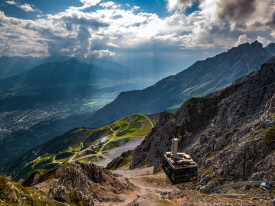
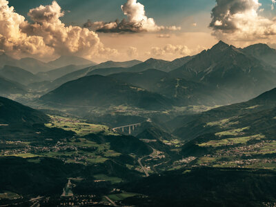
The Hafelekar Station is located at an elevation of 2269 meters in the Nordkette, a striking mountain range that rises directly north of Innsbruck. It marks a transition point between the rugged, limestone-alpine summit regions and the lower-lying, forested flanks that steeply descend into the Inn Valley. The location offers a far-reaching view over the city and the surrounding valleys of the Central Alps.
The topography here is characterized by steep terrain, with rocky slopes and scree fields that transition into gentler alpine pastures before merging into the forested slopes. The gondola lift overcomes large differences in elevation and passes through various vegetation zones, from the treeless alpine zone to the first coniferous forests. The station itself is integrated into the rock landscape and serves as a starting point for alpine hikes.
The view from the station reveals the layering of the landscape: In the foreground, the rough rock structures of the Hafelekar, behind them the gentler green tones of the slopes below, followed by the urban band of Innsbruck on the valley floor. On the horizon rise the high peaks of the Stubai and Tux Alps, creating a deep spatial effect.
Hafelekar Station
| Coordinates | 64.572498, 25.595057 |
| Elevation | 2231 m |
| Taken | 20.09.2020 |
Save
0
☀ Sun & Moon today
calculating…
— Rise
— Set
— Moon
— Camera