0
 Cover
Cover
0
0
Log in to upload photos to this spot.
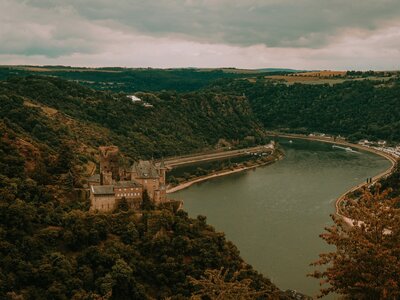
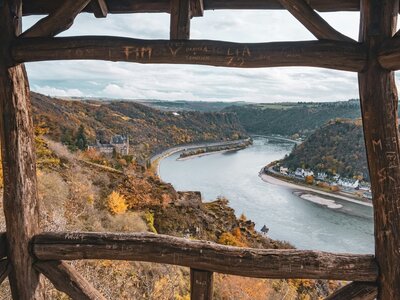
The view from this point opens over the striking Rhine Valley, where the river forms a wide loop. Here, high above the water, the Loreley Plateau can be surveyed in its full extent. Down by the riverbank, railway lines and a riverside road wind along the steep slope, while on the opposite side, Katz Castle stands out as a prominent point overlooking the forested slope zone.
The landscape is formed by the deeply cut banks that rise on both sides of the Rhine, creating a narrow, sheltered river landscape. From this height, the river itself appears like a broad ribbon winding through the hilly surroundings and capturing the vastness of the horizon.
Access: A parking lot is located approximately 170 meters away, and the "Friedhof" (Cemetery) bus stop is a good 250 meters away.
Loreley
| Coordinates | 46.914007, 16.205882 |
| Elevation | 206 m |
| Taken | 29.06.2020 |
Save
0
☀ Sun & Moon today
calculating…
— Rise
— Set
— Moon
— Camera